• Skip to primary navigation
  • Skip to main content
  • Skip to primary sidebar

Tyler Barron

  • Home
  • Around My Home Project 2-4
    • Story
    • Context and Social Media
    • Climate and renewable energy
  • Around the Campus Projects 5-8
    • Location and team
    • Microclimate
    • Walkability
    • Ecosystem services
  • Site Suitability Projects 9-14
    • Geoplanner 1
    • Geoplanner 2
    • Geoplanner 3
    • Geoplanner 4 – Story Map
  • Final Project
  • About

Geoplanner 1

a86316a9d2cfd563d59c78a58527db64

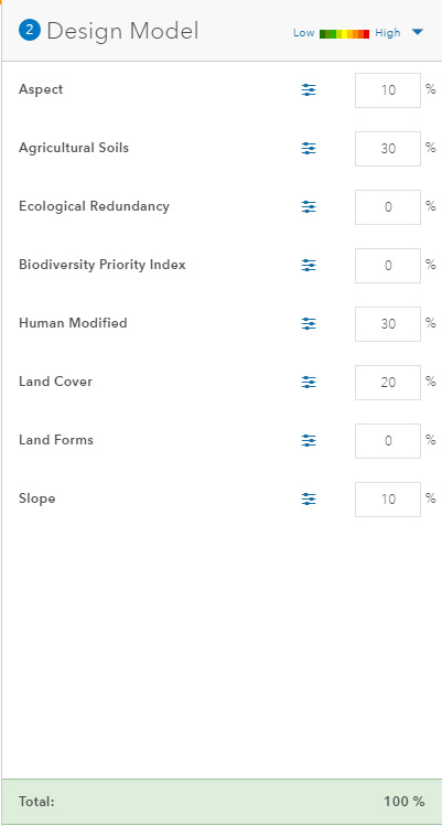
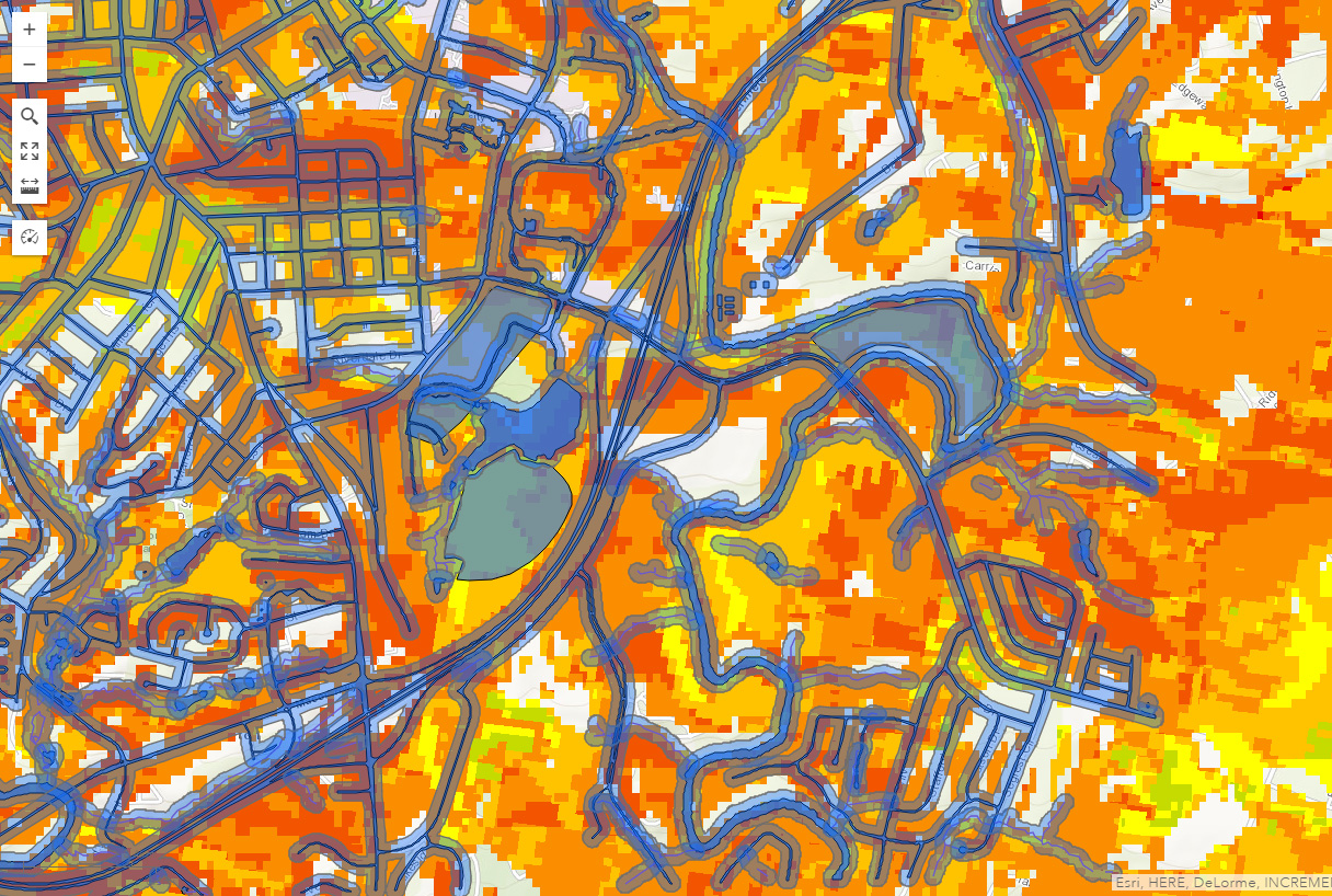
Featured here is the outline of a weighted suitability map for my snail farm in the Athens area. The areas in green are the best for snail farm development. The legend depicted shows the factors which went into weighing the overall suitability of various locations. Primary factors which went into consideration for snail health were: shade, wetness, soil nutrients, and slope. Aspect was weighed for shade and wetness. Human modification and agricultural soils were weighed fro soil nutrients. Meanwhile, the slope layer was weighed as it is self-explanatory.
geoplanner-snail-legend geoplanner-snail-map

Primary Sidebar

Pages

  • About
  • Around My Home Project 2-4
    • Climate and renewable energy
    • Context and Social Media
    • Story
  • Around the Campus Projects 5-8
    • Ecosystem services
    • Location and team
    • Walkability
  • Blog
  • Final Project
  • Microclimate
  • Site Suitability Projects 9-14
    • Geoplanner 1
    • Geoplanner 2
    • Geoplanner 3
    • Geoplanner 4 – Story Map
  • Welcome
October 2025
M T W T F S S
 12345
6789101112
13141516171819
20212223242526
2728293031  
« Mar    

Copyright © 2025 · Genesis Framework · WordPress · Log in