Using Geoplanner, it is easy to identify suitable sites for any need in any location. In this project, the goal is to determine a suitable site for a snail farm in the Athens, Georgia area. To do this, it is necessary to first research the needs of snails. The species in particular is Helix aspersa maxima. They thrive in mild damp climates. This means the soil must be moist. Since snails are vegetarians, they eat almost anything that grows and especially love rotting material. They are nocturnal, so there mustn’t always be light near them. This means they won’t thrive in a well-developed, well-lit site.
Fortunately, a starting point was given for buffering. The site must be 100 feet from all water bodies and roads and 50 feet from vegetated areas to avoid the casting of shadows. We will also need less than a 10 percent slope. These buffers help to minimize the impact on existing areas sensitive to development. Once these factors were inputted, more complicated factors were considered.
Using the sustainability design model from Geoplanner, the factors: aspect, agricultural soils, land cover, human modified, and slope. Each factor is then divided further by all the possibilities within it. For instance, slope has the option to prioritize slopes from very low to high slopes. For aspect, Northwest was prioritized because it allows ample sun for the snails without having the maximum amount, since they are nocturnal, it is important that they have enough shade even in the summer to make sure they have enough rest. For agricultural soils, prime farmland was prioritized since this will be a farm after all! In land cover, forests and wetlands share the prioritization. This is because snails need moist soil and surrounding vegetation (as long as it is at least fifty feet away). The human modified was set to low as was slope which must be under ten percent.
After configuring the settings within each factor, the factors are rated in importance by percent. For this project the factors were rated as such:
Aspect: 20%
Agricultural Soils: 10%
Land Cover: 30%
Human Modified: 25%
Slope: 15%
These were chosen based on the research conducted about snail habitat. Land cover was chosen as the most important factor since the snails cannot survive without enough moisture in the soil. Following is human modified since it is imperative that there is little interference from the built environment around the snails. They can not thrive in areas developed by humans due to problems such as street lights that disrupt their natural cycle. Aspect is next on the priorities because it affects the amount of light they will receive. Slope follows because they require slopes less than ten percent. Last is agricultural soils. This is because the most important characteristic of the soil is that it is moist and not developed and both of these requirement are already addressed in the land cover type and human modified factors.
With all this information, Geoplanner is ready to map the areas best suited for a snail farm. Below is the output. Green areas indicate places best suited for a snail farm.
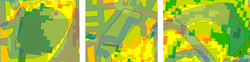
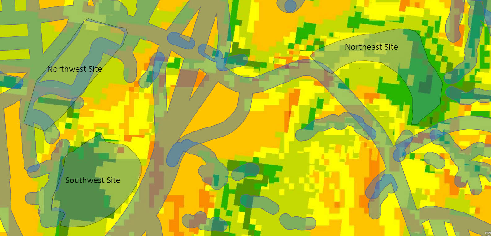
Using the results shown by Geoplanner, it is time to choose the site most suitable. For the next steps of the project, the Northeast site will be further evaluated and designed for our snail farm. However, it will require some comparison to be sure it really is the most suitable. In the following lab, the Northeast site will be comparing with the Northwest (the second seemingly most suitable) to see which comes out on top!