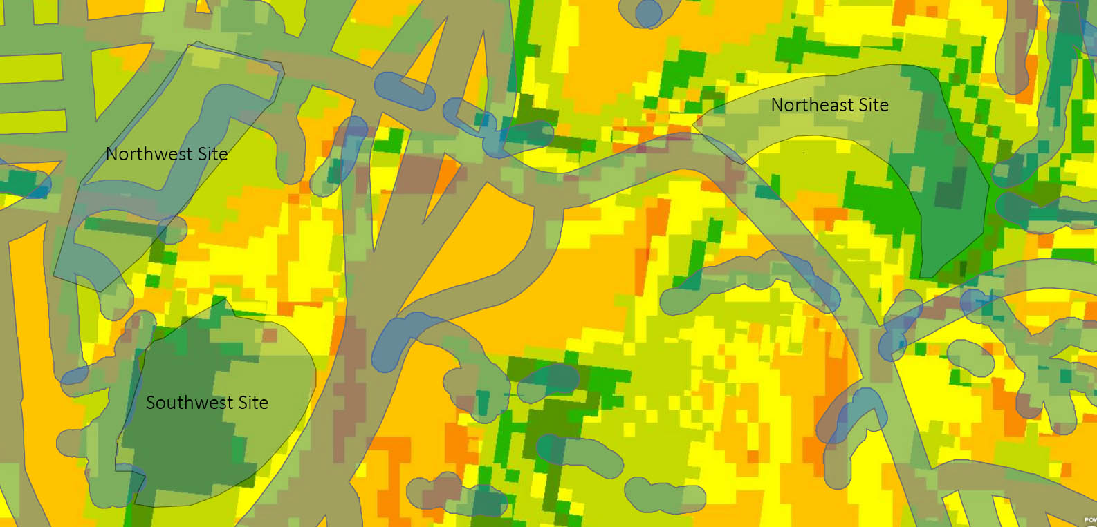
 In Geoplanner 1, a weighted overlay analysis was conducted to find the sites most suitable to snail farming in the Athens area. Remember the image on the left? Now, it’s time to compare the two that seem the most suitable: the Northeast site and the Northwest site. The analysis and buffer zones have been created to guide this process and now, we can also use the dashboard to measure the suitability of the site for different areas.
The areas required are: open space conservation, active recreation field, stormwater management, picnic area, and parking. The dashboard tool analyzes in real time if the site is suitable for the category. It uses the information we provided in the suitability assessment portion to yield results specific to the needs of the snail farm.
Now, there are two scenarios created to judge the northeast site against the northwest.
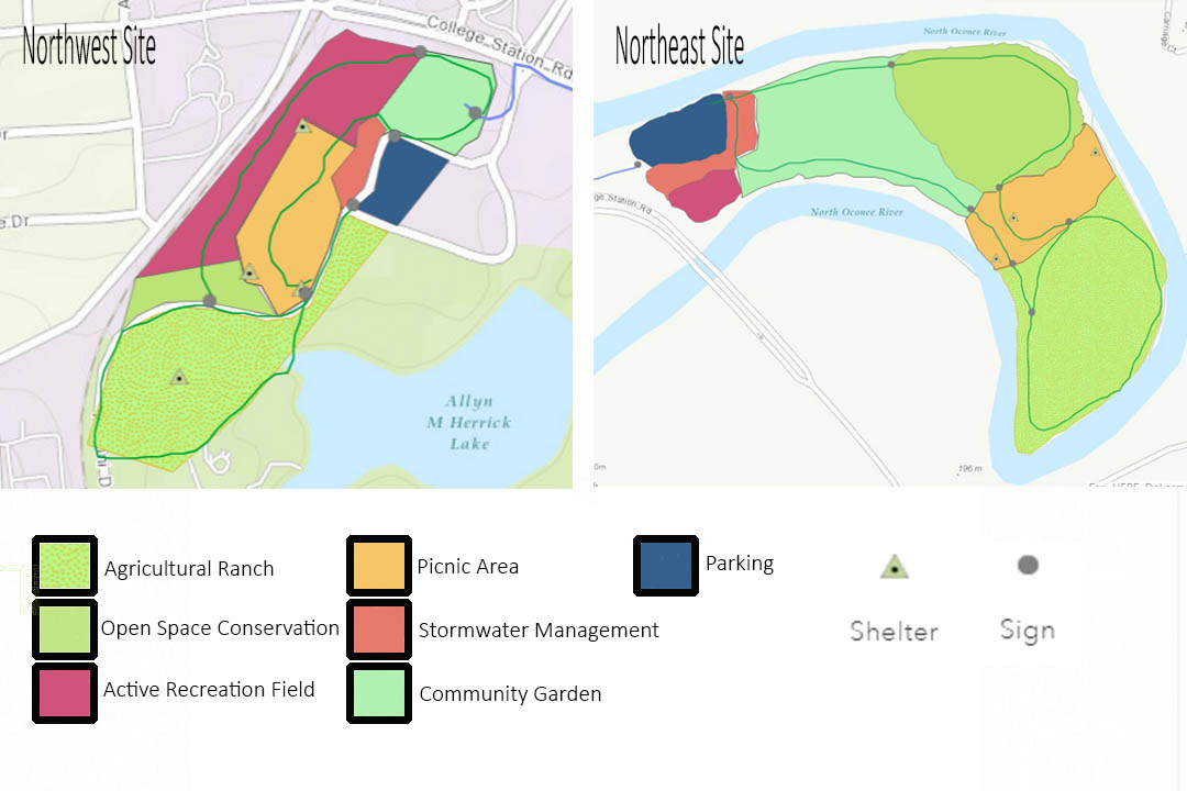
Both sites include each of the 7 categories of areas, access roads, hiking and biking trails, picnic shelters, and signage. The access roads are all off the main highway to provide for good connection. The hiking and biking trails circle through every area of the site and at times intersect and overlap eachother. Signage is provided along the route to direct traffic and picnic shelters are located conveniently along the hiking and biking trails. All the parking lots are surrounded with stormwater management to help mitigate the pavement’s (the main road’s) negative effects and provide a natural transition from the more developed area to the more natural area of the site.
Northeast Site Dashboard Results
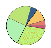
Agricultural Ranch: Medium+ 64.2%, Medium 29.9%, High- 15.9%
Open Space Conservation: Medium+ 38%, Medium 36.5%, Medium- 17.1%, Low+ 4.1%, High 4.3%
Active Recreation Field: Medium 80.3%, Medium- 13.1%, Low+ 6.6%
Picnic Area: Medium+ 46.7%, Medium 36.8%, High 16.5%
Stormwater Management: Medium 63%, Medium- 21.5%, Medium+ 15.5%
Community Garden: Medium 61.4%, Medium- 21.6%, Medium+ 10.3%, Low+ 6.1%
Parking: Medium- 48.6%, Medium+ 36.9%, Medium 14.3%
Northwest Site Dashboard Results
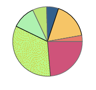
Agricultural Ranch: Medium- 65.3%, Low+ 17.3%, Medium+ 9.6%, Medium 7.8%
Open Space Conservation: Medium- 83.9%, Low+ 14.6%
Active Recreation Field: Medium- 85.2%, Low+ 14.8%
Picnic Area: Medium- 85.2%, Low+ 14.8%
Stormwater Management: Medium- 100%
Community Garden: Medium- 79.7%, Low+ 20.3%
Parking: Medium- 87.4%, Low+ 12.6%
Conclusions
Since the main goal of the site is snail farming, the agricultural ranch is the most vital to the success of of the site as a whole. While the northwest site offers more space for the ranch, the northeast site has better results from the suitability assessment. This trend continues throughout most of the categories. The northeast site has better results of the suitability assessment in all but the community garden category. The only downside is the low amount of space provided for stormwater management and active recreation fields. However, this has allowed for more space for the community garden and open space conservation. Therefore, the northeast site is the superior site for the needs of a snail farm.